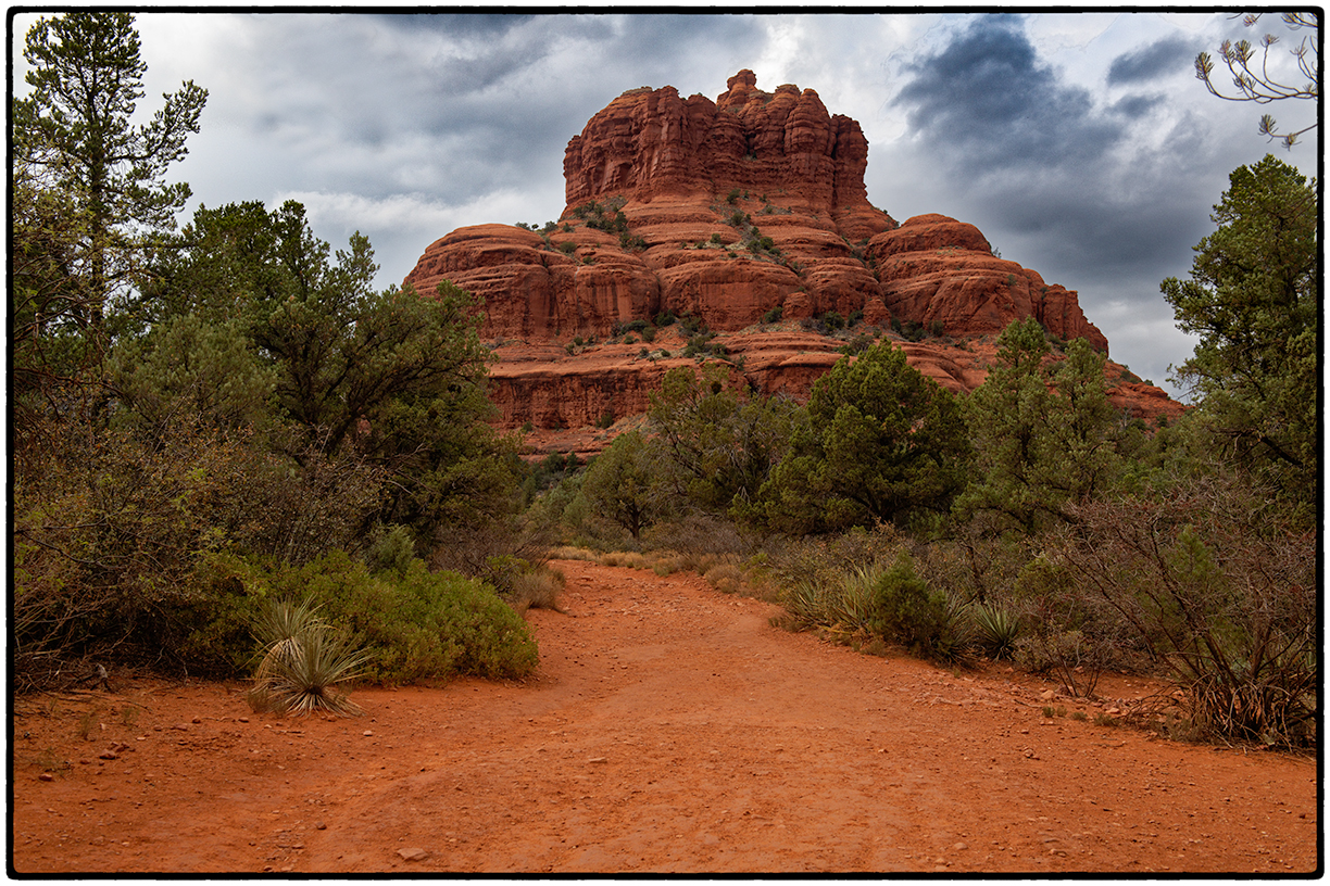
May Day, 2018. Jadyne and I climbed on one of Southwest Airlines' 737s for the ninety minute flight to Phoenix where we met friend Jerry Stack for brunch before heading out in our rented Buick Regal for the two hour drive to our Air B & B in Sedona. One of our first stops was at Bell Rock, famous for its being the center of what was purported to be a "global shift", scheduled to take place on December 21, 2012.
Bell Rock, still intact (although it wasn't predicted to be).
From the Sedona Historical Society, "While we don’t know what may or may not happen in the next few weeks, it is fun to take a look back 25 years to the Harmonic Convergence of 1987 (days of not so yore) to see what the hoopla was all about. If you are not conversant with New Age/New Wave, it is the moment outlined in ancient Mayan calendars to note “the precise calibration points in a harmonic scale that marks the moment when the process of global civilization climaxes.” For those of us old enough to remember the Fifth Dimension of the 1960s, it is the “Dawning of the Age of Aquarius.” Sedona is one of the 12 “power points” or sacred sites worldwide. The other points were not too shabby: Stonehenge, Mt. Olympus, the Great Pyramid, Machu Picchu, and Mt. Fuji, plus a few others not quite so notable. The Mayan calendar marked the date, and the planets cooperated by aligning, also known as a Grand Triune. Local believers took the event very seriously. Organizers of the “world harmony days” anticipated thousands of celebrants to rejoice in the shift from separation and fear to unity and love. Celebrations were expected from international to local levels. In Sedona, there were hot lines of information and free newsletters to keep everyone up to date. The ultimate ritual was 7 minutes of humming at noon Greenwich time (5 a.m. Sedona time) by those actively calling in the era of peace and harmony (not easy to do -- try humming for 7 minutes). Obviously, rumors ran rampant. A space ship would be landing on Bell Rock…Bell Rock would crack in two and the space ship would fly from Inner Earth to Outer Space. The morning humming was to levitate Bell Rock since Bell Rock was to be the spaceship. Devotees were dancing naked around Bell Rock (a rumor only). There even would be a human sacrifice off Apache Leap (west of Bell Rock). Traffic along Hwy. 179 was a nightmare. Remember this was before I79 was reconfigured. Cars were parked from the Circle K northward to the “roller coaster”— do you long timers remember the beloved roller coaster on 179? Flashlights lit the north face of Bell Rock like giant fireflies. Lights from airplanes illuminated the sky over the big red butte. There were some suggestible Bible students who said they saw the stars turn green and a group of stars around the moon change into the shape of a cross -- a sign out of Revelation. The Forest Service counted 1,800 folks on Bell Rock, and motels logged in over 4,000 reservations in town. That would overwhelm the available rooms even today. Three Phoenix television stations were shooting the activity at Bell Rock. The event was great for the local economy. Crystals were for sale on every street corner. Coffee Pot Restaurant (just about the only available eating place in town) was packed from before opening to after closing. What a time!A local pundit called it a “Moronic Convergence.” Alas, had he no romance in his soul!"
Bell Rock, minutes before two unsuspecting jacket-less hikers were pelted by hail.
We spent three days hiking in and around Sedona, attending the tacky souvenir shops and the art galleries, where a sculpted bear was priced at $500,000.
From Sedona to Flagstaff, past miles and miles of barren land belonging to the Navajos. Highway 17 was dotted with mean little houses adorned with pickup trucks and RVs. Along the road in numerous tents and fallen down sheds Navajos were selling, well, I don't know what they were selling, as we didn't stop.
And then to Page, where we spent one night before our morning tour of Antelope Canyon, one of two reasons why people flock to Page, the other being its proximity to Lake Powell and its 186 miles of shoreline.
Lake Powell Marina
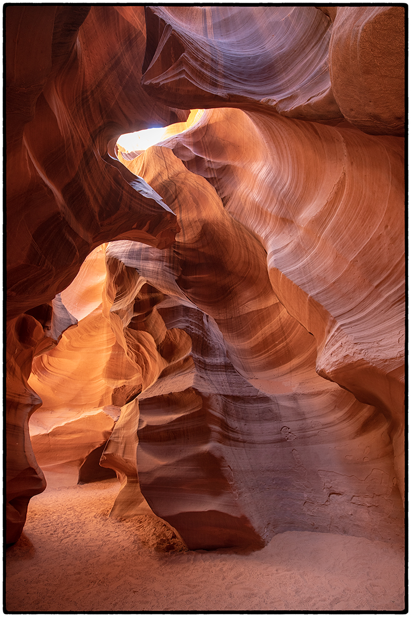
And then Upper Antelope Canyon, a heritage site on Navajo property. To see Antelope Canyon one must register with one of five companies who lead people through the maze. Called "Tse Bighanilini" or "the place where water runs through rocks", Antelope Canyon has seen over 100,000 visitors in the last month...and I think that they all visited there last Saturday.
"Antelope Canyon was formed by erosion of Navajo Sandstone, primarily due to flash flooding. Rainwater, especially during monsoon season, runs into the extensive basin above the slot canyon sections, picking up speed and sand as it rushes into the narrow passageways. Over time the passageways eroded away, making the corridors deeper and smoothing hard edges in such a way as to form characteristic "flowing" shapes in the rock. Flooding still occurs. A flood occurred on October 30, 2006 that lasted 36 hours, and caused the Tribal Park Authorities to close the Lower Antelope Canyon for five months." Wikipedia
Here is one of the hundreds of images I was able to make amidst the crowds at Upper Antelope Canyon last Saturday. The canyon and the experience were at odds with each other, The former was a dream; the latter, a nightmare. Besides the number of people flooding the canyon, there are additional photographic challenges that beset amateurs unaccustomed to atypical conditions, the most important of which is the wide exposure range, often 10 EV or more, that make it impossible to render any given image properly. Only HDR images, taken by bracketing as many as three to five exposures, allow the photographer to sandwich images to capture the darkest darks and the lightest lights. And doing this among the hundreds of sightseers tripping over the tripod legs, required a full plate of patience.
Check here if you're still reading this. If I were you, I wouldn't read any more. Don't waste your time. You have better things to do.
To further complicate matters I'm providing a link below to additional images that I've placed on my web site, including a dozen or so images from Upper Antelope Canyon.


